Blog
Using a 3D Mouse With Google Earth: Navigation Ideas
Jul
Google Earth is one of the easiest ways to understand why spatial navigation feels different from normal scrolling. You are not only moving up and down a page. You are flying over terrain, tilting the view, zooming into cities, rotating around landmarks, and presenting places to other people. That makes it a friendly practice ground for broader 3D mouse navigation terminology.
A 3D mouse can make that kind of movement feel more natural if the application, browser, operating system, and device setup support it. The use case is different from CAD precision, but the navigation idea is related.
Flying, tilting, zooming, and terrain exploration
The main movements are easy to picture. Flying moves across the map. Tilting changes the viewing angle. Zooming moves closer to or farther from terrain. Rotating helps inspect landmarks, mountains, campuses, neighborhoods, or planning areas from more than one direction.
These motions are useful when the map is being studied as a 3D environment. A geography lesson, city planning preview, real estate walkthrough, travel presentation, or terrain discussion can all benefit from smoother movement.
Education and presentation examples
In classrooms, a teacher can use smooth navigation to guide students from a continent to a city, then down to a landmark or terrain feature. In planning, a team can move through a project area and discuss access, slope, distance, or context. In presentations, slower movement helps the audience stay oriented.
The key is pacing. Fast map movement can be fun, but it can also make people lose track of where they are. Slow movement, pauses, and clear destinations make Google Earth easier to follow.
Compatibility caveats
Google Earth can be used in different forms, and input behavior may vary by browser, app version, operating system, and device support. Before buying a 3D mouse for this purpose, test the exact setup you plan to use. Check pairing, sensitivity, axis direction, and whether the navigation feels predictable.
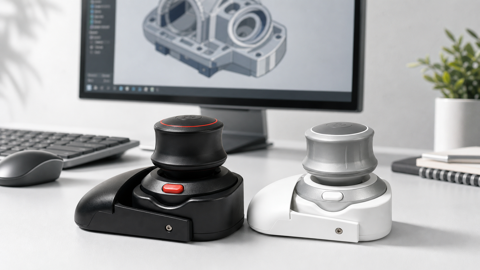
The Wireless 3D CAD Mouse includes Google Earth style navigation in its product positioning, making this a key use case to evaluate. It is still wise to verify behavior on your own computer before building a lesson, meeting, or presentation around it.
How it differs from CAD use
In CAD, navigation often supports precision modeling and inspection. In Google Earth, navigation supports exploration, storytelling, and spatial understanding. The same controller may be used, but the success criteria are different. You want movement that is smooth, readable, and comfortable for viewers.
If you also use CAD or 3D modeling tools, Google Earth can be a lower-pressure way to practice smooth movement before moving into more technical software.
FAQ
Is a 3D mouse useful for Google Earth presentations?
It can be, especially when smooth flying, tilting, and zooming help the audience understand a place.
Does it work the same in every Google Earth setup?
No. Browser, app version, OS, and device support can affect behavior, so test first.
Who might benefit?
Teachers, planners, presenters, geography students, real estate teams, and people exploring terrain or city context.
What should I practice?
Practice slow zooms, controlled tilts, landmark rotations, and returning to a broad context view.
Bottom line
A 3D mouse with Google Earth is about smooth spatial storytelling. If flying through places is part of your teaching, planning, or presentation work, it is a useful workflow to test.